
This is the official NCERT Class 12 Geography Chapter 2 Human Settlements PDF — the Human Class 12 chapter on settlements from the book India: People and Economy. The download link below opens NCERT’s own file, and the rest of this page explains every section in plain words so you can study without opening another tab.
Keep this page open beside the chapter: use it for the definitions, the comparison tables and the figure-by-figure reading, and keep the PDF for the exact text and NCERT’s own layout.
Download the NCERT Class 12 Geography Chapter 2 Human Settlements PDF
The file below is NCERT’s official edition of the chapter — the version your school copy is printed from, with the full text, the diagrams and Table 2.1 exactly as published.
NCERT Class 12 Geography Chapter 2 Human Settlements PDF — open this official chapter file on ncert.nic.in to read the complete text of Human Settlements, its four photographs and the 1901–2011 urbanisation table just as they appear in the printed book, free of any reformatting.
| What the chapter holds | Count | Where it is used |
|---|---|---|
| Printed pages | 6 | |
| Figures with NCERT captions | 6 | |
| Tables | 1 | |
| Exercise questions | 3 | answered in our NCERT Solutions |
| Official NCERT PDF | Download the chapter PDF | the chapter exactly as NCERT publishes it |
Chapter 2 Human Settlements at a Glance
The table below lists what the chapter file holds, so you can see the shape of the chapter before you open it.
| Feature | What Chapter 2 holds |
|---|---|
| Sections | 25, from Types of Rural Settlement to Tourist towns, plus the exercises |
| Captioned figures (diagrams) | 4 — Figs 2.1 to 2.4 |
| Data tables | 1 — Table 2.1, India: Trends of Urbanisation 1901–2011 |
| PDF pages | 6 |
| Exercise questions | 3 questions with 19 parts |
What Chapter 2 Human Settlements Covers
The chapter opens by defining a settlement — a cluster of dwellings with a territory behind it — and then separates rural from urban settlements by what they do: villages live off the land, towns process, manufacture and serve.
Next comes the classification of rural settlements into four types, decided by how built-up the village is and how far apart the houses stand. The chapter then switches to towns: the census supplies one official test for what counts as urban, and the evolution section sorts Indian towns into ancient, medieval and modern periods.
Table 2.1 carries the full 1901–2011 urbanisation record, and the longest section classifies towns by their dominant function — from administrative to tourist. The chapter closes with a set of exercises.
Key Concepts in Chapter 2
Six ideas carry this chapter, and each builds on the last. Read them in order and you will have the whole argument before touching the exercises.
What a Human Settlement Is: Rural versus Urban
A human settlement is any cluster of dwellings, of any size, where people live — together with the territory that supports them. The chapter needs this idea first because every later classification sorts settlements by size, function and history, and the rural–urban divide is the biggest sort of all.
| Point of comparison | Rural settlements | Urban settlements |
|---|---|---|
| Economic base | Land-based primary activities — farming, herding, fishing | Processing raw materials, manufacturing finished goods, and services |
| Role in the region | Produce food and raw materials | Nodes of economic growth serving a hinterland through transport and communication |
| Social life | Less mobile people; intimate social relations | Complex, fast way of life; formal social relations |
One more point from the opening section matters: cities and villages are not separate worlds. Cities supply goods and services to the villages of their hinterland in return for food and raw materials, and that exchange travels along transport and communication networks.
The Four Types of Rural Settlements
Settlement type is set by two visible measurements: how much area the built-up part covers, and how far the houses stand from one another. NCERT names three forces behind the pattern — physical features (terrain, altitude, climate, water), cultural and ethnic factors (social structure, caste, religion), and security against theft and robbery.
| Type | Shape / pattern | Where found in India | Why it forms there |
|---|---|---|---|
| Clustered (agglomerated or nucleated) | Compact, closely built houses; geometric shapes such as rectangular, radial, linear | Fertile alluvial plains; north-eastern states; Bundelkhand; Nagaland; Rajasthan | Fertile land; security against attack; in Rajasthan, water scarcity forces compact use of water |
| Semi-clustered (fragmented) | One or more sections split off from the main cluster | Gujarat plain; parts of Rajasthan | Segmentation of a large village; the land-owning community holds the centre, lower strata and menial workers settle on the outer flanks |
| Hamleted | A single village fragmented into named units — panna, para, palli, nagla, dhani | Middle and lower Ganga plain; Chhattisgarh; lower Himalaya valleys | Social and ethnic segmentation of a large village |
| Dispersed (isolated) | Isolated huts or few-hut hamlets, often on slopes with farms or pasture | Meghalaya, Uttarakhand, Himachal Pradesh, Kerala | Extremely fragmented terrain and scattered habitable land |
The photographs of the first three types sit inside this section of the book — the figure walkthrough below reads each one and ties it back to these descriptions.
The Census Definition of an Urban Settlement
Rural and urban are easy to tell apart in daily life, but the chapter needs one test that works for every place in India. The Census of India 1991 supplies it, and a place counts as urban only if it passes all four conditions together.
- It has a local body — a municipality, corporation, cantonment board or notified town area committee.
- Its population is at least 5,000 persons.
- At least 75 percent of male workers are engaged in non-agricultural pursuits.
- Its density is at least 400 persons per square kilometre.
Memorise it as 5-75-400 plus one body. Five thousand persons, seventy-five percent, four hundred per square kilometre, and one local body — municipality, corporation, cantonment board or notified town area committee.
Condition three is where students slip: it says male workers, not the whole population. The census counts at least 75 percent of male workers in non-agricultural pursuits.
Exercise Q1(ii) of this chapter is built around exactly that confusion. Its wrong-looking option says “more than 75% of the population engaged in primary sector” — wrong on “male” and wrong on “non-agriculture” — so that option is the one that is NOT part of the definition.
Ancient, Medieval and Modern Towns
Indian towns have existed since prehistoric times — Harappa and Mohenjo-daro are named in the chapter — and NCERT classifies the towns of today by the period in which they grew. Each period left a different kind of town.
| Period | What the towns were | Example towns |
|---|---|---|
| Ancient | Religious and cultural centres, with history spanning over 2,000 years | Varanasi, Prayag (Prayagraj), Pataliputra (Patna), Madurai |
| Medieval | Fort towns that grew as headquarters of principalities and kingdoms; about 100 existing towns, many built on the ruins of ancient towns | Delhi, Hyderabad, Jaipur, Lucknow, Agra, Nagpur |
| Modern | British and other European towns — coastal trading ports, the three principal nodes, hill towns as summer resorts, post-1850 industrial towns — and after independence, new administrative headquarters, industrial centres and satellite towns | Surat, Daman, Goa, Pondicherry; Mumbai, Chennai, Kolkata; Jamshedpur; Chandigarh, Bhubaneswar, Gandhinagar, Dispur; Durgapur, Bhilai, Sindri, Barauni; Ghaziabad, Rohtak, Gurugram |
Fig 2.4, the photograph of a modern city, belongs to this section — the figure walkthrough reads it below.
Urbanisation in India: Reading Table 2.1
The level of urbanisation is measured as the percentage of urban population to total population, and Table 2.1 records that percentage for every census year from 1901 to 2011. Three facts from the table anchor the whole section.
- The 2011 level was 31.16 percent — low compared with developed countries.
- Urban population increased eleven-fold during the twentieth century.
- The growth rate of urbanisation slowed during the last two decades.
Worked example — the 2001–2011 decade from Table 2.1. Urban population rose from 2,85,355 thousand in 2001 to 3,77,000 thousand in 2011.
- Urban population added: 3,77,000 − 2,85,355 = 91,645 thousand (about 9.16 crore).
- Towns and urban agglomerations: 5,161 (2001) to 6,171 (2011) — an addition of 1,010.
- The 2011 decennial growth column reads 31.08 percent — that is the decade’s growth rate, separate from the level.
Two subtleties stop the table from misleading you. First, the “eleven-fold” claim belongs to the twentieth century (1901–2001): urban population grew from about 25,851.9 thousand to about 2,85,355 thousand, roughly eleven times. Do not apply the eleven-fold figure to 2011.
Second, keep the two 31s apart: 31.16 percent is the 2011 level of urbanisation, while 31.08 percent is the 2011 decennial growth rate. The book sources Table 2.1 to the Census of India, whose website carries the provisional 2011 figures.
The Functional Classification of Towns: Types and Examples
Beyond their role as central places, many Indian towns are known for one dominant function, and NCERT classifies towns by it. This is the chapter’s longest list and its most memory-heavy table, because every class carries named towns you are expected to match.
| Class | What defines it | Example towns |
|---|---|---|
| Administrative | Headquarters of higher-order administration | Chandigarh, New Delhi, Bhopal, Shillong, Guwahati, Imphal, Srinagar, Gandhinagar, Jaipur, Chennai |
| Industrial | Industry is the prime motive force | Mumbai, Salem, Coimbatore, Modinagar, Jamshedpur, Hugli, Bhilai |
| Transport — ports | Primarily engaged in export and import | Kandla, Cochin, Kozhikode, Vishakhapatnam |
| Transport — inland hubs | Hubs of inland transport | Agra, Dhulia, Pandit Deendayal Upadhyay Nagar, Itarsi, Katni |
| Commercial | Specialise in trade and commerce | Kolkata, Saharanpur, Satna |
| Mining | Developed in mineral-rich areas | Raniganj, Jharia, Digboi, Ankaleshwar, Singrauli |
| Garrison | Emerged as military cantonment towns | Ambala, Jalandhar, Mhow, Babina, Udhampur |
| Educational | Centres of education grown into campus towns | Roorki, Varanasi, Aligarh, Pilani, Prayagraj |
| Religious and cultural | Came to prominence through religious or cultural significance | Varanasi, Mathura, Amritsar, Madurai, Puri, Ajmer, Pushkar, Tirupati, Kurukshetra, Haridwar, Ujjain |
| Tourist | Tourist destinations | Nainital, Mussoorie, Shimla, Pachmarhi, Jodhpur, Jaisalmer, Udagamandalam (Ooty), Mount Abu |
One policy item belongs to this list. The Smart Cities Mission aims at towns that provide core infrastructure, a clean and sustainable environment and a decent quality of life, applying smart solutions to infrastructure and services — fewer resources, cheaper services, lower vulnerability to disasters — in compact areas that can act as a replicable “lighthouse” model for other aspiring cities.
The book also suggests an activity here: list the urban agglomerations state-wise and examine the state-wise population under this category.
The section ends with the idea Exercise Q3(ii) asks about: cities are not static. As specialised cities grow into metropolises, they become multifunctional — industry, business, administration and transport all become important, so entwined that the city can no longer be filed under one function.
Figure Walkthrough: What the Settlement Photographs Show


The photographs the chapter prints are not decoration — each one is the text made visible, a settlement pattern you would recognise from a hillside or an aircraft. Reading them with the caption is how the chapter expects you to identify settlement types.
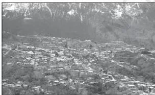
Fig 2.1 belongs to the Clustered Settlements section. The photograph shows a single compact mass of houses with lanes threading between them, standing clearly apart from the surrounding farmland — exactly the text’s two marks of a clustered settlement: a closely built-up living area separated from the farms, barns and pastures around it.
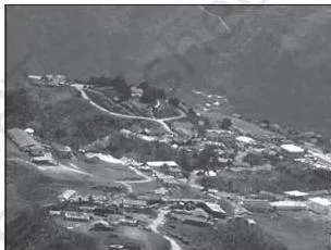
Fig 2.2 sits beside the Semi-Clustered Settlements section. The main village cluster is visible, with one or more sections living away from it — the visual form of the text’s description, in which the land-owning dominant community holds the centre while lower strata and menial workers settle on the outer flanks.
The book places this pattern in the Gujarat plain and parts of Rajasthan.
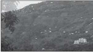
Fig 2.3, from the Dispersed Settlements section, shows Nagaland: isolated huts strung across hill slopes with farm plots or pasture between them. The cause given in the text is extremely fragmented terrain — habitable patches lie so far apart that no compact village can form.
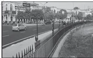
Fig 2.4 belongs to the Evolution of Towns section, not the rural settlement pages. It shows the modern city — dense, compact, multi-storey — the built environment the chapter contrasts with rural villages.
The section relates it to the British and other Europeans: first coastal trading ports like Surat, then the three principal nodes Mumbai, Chennai and Kolkata, then post-independence administrative and industrial centres.
Key Definitions in Human Settlements
Every term the exercises use is precise. Learn each definition in one line, with the example towns the book attaches to it — this table is for quick recall in the last pass before an assessment.
| Term | Definition and example from the chapter |
|---|---|
| Human settlement | Cluster of dwellings of any type or size where people live, with a territory as their economic support base. Range: hamlet to metropolitan city. |
| Clustered settlement | Compact, closely built-up living area separated from surrounding farms, often in a geometric shape (rectangular, radial, linear). Regions: fertile alluvial plains, north-eastern states, Bundelkhand, Nagaland, Rajasthan. |
| Semi-clustered settlement | A village with one or more sections living away from the main cluster; the dominant community holds the centre. Regions: Gujarat plain, parts of Rajasthan. |
| Hamleted settlement | One large village fragmented into physically separate named units — panna, para, palli, nagla, dhani. Regions: middle and lower Ganga plain, Chhattisgarh, lower Himalaya valleys. |
| Dispersed settlement | Isolated huts or few-hut hamlets scattered over fragmented terrain. Regions: Meghalaya, Uttarakhand, Himachal Pradesh, Kerala. |
| Urban settlement | A place with a municipality, corporation, cantonment board or notified town area committee; at least 5,000 persons; 75 percent of male workers in non-agriculture; density of at least 400 per sq km. |
| Ancient town | Town with history spanning over 2,000 years, mostly religious and cultural centres. Examples: Varanasi, Prayag, Pataliputra (Patna), Madurai. |
| Medieval town | Fort town that grew as headquarters of principalities and kingdoms. Examples: Delhi, Hyderabad, Jaipur, Lucknow, Agra, Nagpur. |
| Modern town | Town developed by the British and other Europeans, or after independence. Examples: Surat, Mumbai, Chennai, Kolkata, Jamshedpur, Chandigarh, Durgapur, Ghaziabad. |
| Garrison town | Town that emerged as a military cantonment town. Examples: Ambala, Jalandhar, Mhow, Babina, Udhampur. |
| Smart Cities Mission | Policy for core infrastructure, a clean sustainable environment and smart solutions in compact, replicable “lighthouse” areas. |
Common Mistakes Students Make in Human Settlements
None of this chapter’s ideas are hard — the traps are definitional and example-based. Four mistakes catch most students, and each one is avoidable.
| Mistake | Correct rule | How to check your answer |
|---|---|---|
| “75 percent of the total population” | The census requires at least 75 percent of male workers in non-agricultural pursuits | Re-read Q1(ii): the wrong option says “more than 75% of the population engaged in primary sector” — wrong on “male” and wrong on “non-agriculture”, so it is NOT part of the definition |
| Mixing hamleted with dispersed | Hamleted: one large village split into named units (panna, para, palli, nagla, dhani). Dispersed: isolated huts that never formed a village | Ask one question: is there a single original village? Yes → hamleted; no → dispersed |
| Confusing the two 31s | 31.16 percent is the 2011 level (urban share of total population); 31.08 percent is the 2011 decennial growth rate — and the growth rate has slowed over the last two decades | Before answering any Table 2.1 question, decide: does it ask the share, or the rate of increase? |
| Swapping example towns between periods | Patna is ancient (Pataliputra); Agra is medieval; Jamshedpur is modern post-1850 industry; Chandigarh is post-independence administration | Learn each town with the reason it grew — the reason is the memory hook, not the bare name |
Exam-Focused Notes for Human Class 12 Geography Chapter 2
The chapter’s material is mostly definition recall, classification with examples, and one data table — so the same three skills underpin every question this material can support. Drill them directly and the exercises stop being a problem.
- Memorise the census test as 5-75-400 plus a local body, and say it aloud until the “male workers” clause sticks.
- Practise naming at least two towns for every functional class, and the regions for every rural settlement type.
- Practise Table 2.1 questions that separate the level (31.16) from the decennial growth rate (31.08).
The chapter’s exercises test exactly those three skills. Here is where each answer lives in the text:
| Exercise | What it tests | Sections that answer it |
|---|---|---|
| Q1 (i)–(iii): MCQs | Census definition recall; settlement-type recognition; example-town knowledge | Urban Settlements; Types of Rural Settlement; Functional Classification of Towns |
| Q2 (i)–(ii): 30-word answers | Concise definition plus function; physical factors behind village location | Functional Classification (garrison towns); Clustered Settlements (the Rajasthan water-scarcity point) |
| Q3 (i)–(ii): 150-word answers | Full rural classification with factors; why cities become multifunctional | Types of Rural Settlement; the closing paragraph of Functional Classification |
Two of the three MCQs answer directly from the chapter text. Q1(ii) is the census definition — option (c), “more than 75% of the population engaged in primary sector”, is the one NOT part of it. Q1(iii) is the dispersed-settlement environment — forests and hills in the north-east, where Meghalaya sits.
Q1(i) is different: the chapter names all four towns but does not state which lie on rivers, so settle that one from an atlas rather than the chapter.
One honest warning: textbook contents and the examinable syllabus are not always identical — check the current official syllabus before deciding what to revise, and confirm coverage with your teacher.
Once this chapter is done, the CBSE Class 12 Geography notes hub carries chapter-wise revision material for the subject, and the Class 12 hub on CBSE notes gathers notes for every subject at this level.
One-Pass Recap: Human Settlements
The chapter closes with exercises rather than a boxed summary, so this recap is built from the chapter’s own argument. Read the paragraph, then the table — thirty seconds, full coverage.
A human settlement is a cluster of dwellings with a territory as its resource base. Villages live off land-based primary activities; cities process, manufacture, serve, and act as nodes of growth linked to their hinterlands. Rural settlements come in four types — clustered, semi-clustered, hamleted and dispersed — shaped by physical, cultural and security factors.
The census test for urban is 5,000 persons, 75 percent male workers in non-agriculture, 400 persons per sq km, plus a local body. Towns evolved as ancient religious centres, medieval fort headquarters, and modern European and post-independence towns, while Table 2.1 records urbanisation reaching 31.16 percent by 2011.
| Stage of the chapter | Idea to remember | The detail that carries marks |
|---|---|---|
| Definition | Settlement = dwellings + territory as resource base | Rural = primary, land-based; urban = processing, manufacturing, services |
| Rural types | Built-up area and inter-house distance decide the type | Clustered, semi-clustered, hamleted, dispersed — each with its regions |
| Urban test | Census of India 1991, four conditions | 5,000; 75% male workers in non-agriculture; 400 per sq km; a local body |
| Evolution | Three periods | Ancient (Varanasi, Patna, Madurai), medieval (Delhi, Agra, Jaipur), modern (Mumbai, Jamshedpur, Chandigarh) |
| Functions | One dominant function classifies a town | Administrative, industrial, transport, commercial, mining, garrison, educational, religious, tourist + Smart Cities Mission |
Related NCERT Class 12 Geography Chapters
To move around the book, open the NCERT Class 12 Geography book page — every chapter of India: People and Economy is listed there with its official PDF, including the chapters immediately before and after this one. The Class 12 hub gathers the NCERT books for every subject at this level.
For notes-based revision, the CBSE Class 12 Geography notes hub carries chapter-wise material, including the Data – Its Source and Compilation chapter and the Human Development chapter, and the full CBSE notes index links every class and subject from one page.
Sources and Data Verification
This listing is maintained for the 2026-27 academic session using the NCERT textbook information available to us. NCERT remains the authority for confirming the latest edition.
- The chapter description above reflects the NCERT Class 12 Geography textbook India: People and Economy, Chapter 2 — Human Settlements — the official edition published on ncert.nic.in.
- This page covers only Chapter 2 of that book; the other chapters of India: People and Economy are not described here.
- The listing is maintained for the current academic session. Textbook contents and the examinable syllabus are not always identical — check the current official CBSE syllabus for what is examinable.
- NCERT settles textbooks, editions and official PDFs; CBSE settles curriculum, syllabus and examinations.
Reference: NCERT Class 12 Geography textbook, chapter 2, official edition on ncert.nic.in.
Frequently Asked Questions about Human Settlements Class 12
Quick answers to the questions students search for after reading this chapter, each answer starting with the answer.
What is the census definition of an urban settlement in India?
The Census of India 1991 defines a place as urban when it satisfies four conditions together: it has a municipality, corporation, cantonment board or notified town area committee; its population is at least 5,000; at least 75 percent of its male workers are engaged in non-agricultural pursuits; and its density is at least 400 persons per square kilometre.
The chapter uses this definition as the official urban–rural test, and Exercise Q1(ii) checks whether you can spot a condition that does not belong to it.
What are the four types of rural settlements in India?
Clustered — a compact, closely built-up village separated from surrounding farmland, found in fertile alluvial plains, the north-eastern states, Bundelkhand, Nagaland and Rajasthan. Semi-clustered — one or more sections living away from the main cluster, as in the Gujarat plain and parts of Rajasthan.
Hamleted — a single large village split into named units (panna, para, palli, nagla, dhani), found in the middle and lower Ganga plain, Chhattisgarh and the lower Himalaya valleys. Dispersed — isolated huts or few-hut hamlets, found in Meghalaya, Uttarakhand, Himachal Pradesh and Kerala.
Which towns are ancient, medieval and modern in India?
Ancient towns are religious and cultural centres with history spanning over 2,000 years: Varanasi, Prayag (Prayagraj), Pataliputra (modern Patna) and Madurai. Medieval towns are fort towns that grew as headquarters of principalities and kingdoms, about 100 of them still existing: Delhi, Hyderabad, Jaipur, Lucknow, Agra and Nagpur.
Modern towns were developed by the British and other Europeans plus post-independence India — trading ports like Surat, the three principal nodes Mumbai, Chennai and Kolkata, industrial Jamshedpur, and later Chandigarh, Durgapur, Bhilai and satellite towns like Ghaziabad, Rohtak and Gurugram.
What was the level of urbanisation in India in 2011 and what does it mean?
The level of urbanisation in 2011 was 31.16 percent — the share of India’s total population living in urban settlements — which the chapter calls low compared with developed countries. Separately, the decennial growth rate for 2001–2011 was 31.08 percent.
The chapter also notes two long-term facts: urban population increased eleven-fold during the twentieth century, and the growth rate of urbanisation has slowed over the last two decades.
What are garrison towns and which Indian towns are examples?
Garrison towns are towns that emerged around military stations or cantonments. NCERT’s examples are Ambala, Jalandhar, Mhow, Babina and Udhampur. Their function is tied to that military origin — Exercise Q2(i) of the chapter asks you to state the definition and the function together.
Is the whole Human Settlements chapter examinable in Class 12?
Textbook contents and the examinable syllabus are not always identical. Chapter 2 Human Settlements is part of NCERT’s Class 12 Geography book India: People and Economy and appears in the book you are meant to study — but which parts are examinable in your session is set by the current official CBSE syllabus.
Check that syllabus, and confirm coverage with your teacher, before deciding what to revise.
Explore Class 12 Geography Books
Related chapters: