These lifelines of national economy class 10 notes are prepared for the current academic session to help you revise Chapter 7 of Contemporary India II. Goods and services do not move from supply locations to demand locations on their own. The movement of these goods and services requires transport, and efficient means of transport are prerequisites for fast development (NCERT, p. 71).
Transport, communication, and trade are complementary to each other. A dense and efficient network of these three lifelines drives local, national, and global trade today. For more revision materials across the subject, you can browse our complete collection of Class 10 Geography notes.
Chapter Overview: Transport, Communication, and Trade Networks
The chapter builds a mental scaffold of how India moves goods, people, and information. Before diving into details, use this comparison table to map the six pillars of the economy to their primary function and a unique key feature.
| Lifeline | Primary Function | Key Feature |
|---|---|---|
| Roadways | Feeder service to other modes; door-to-door connectivity | Second largest network in the world; 6 road classes |
| Railways | Principal mode for freight and passengers over long distances | Largest public sector undertaking; 17 zones |
| Pipelines | Transport crude oil, petroleum, natural gas, and slurry | Rules out trans-shipment losses and delays |
| Waterways | Carry heavy and bulky goods | Cheapest means; fuel-efficient and environment friendly |
| Airways | Fastest transport over difficult terrains | Preferred in north-eastern states; UDAN scheme |
| Trade | Exchange of goods and services | Economic barometer; balance of trade indicates prosperity |
Together, these pillars form the lifelines that connect India to the rest of the world. You can find more resources for your board preparation on our Class 10 notes hub.
Key Concepts Build-Up: From Roadways to Airways
Teachers build this chapter from the most accessible mode (roads) to the fastest (airways). Understanding why roads precede railways helps you grasp the logic of India’s transport hierarchy.
Roadways: Six Classes of Roads
India has the second largest road network in the world, aggregating to about 62.16 lakh km (2026-27). Roadways have an edge over railways because construction cost is lower, roads can traverse dissected topography, negotiate higher gradients, and provide door-to-door service (NCERT, p. 71).
- Golden Quadrilateral Super Highways: Six-lane highways linking Delhi-Kolkata-Chennai-Mumbai and Delhi. The North-South corridor links Srinagar to Kanniyakumari, and the East-West corridor connects Silchar to Porbander. Implemented by the National Highways Authority of India (NHAI).
- National Highways: Link extreme parts of the country; primary road systems.
- State Highways: Link a state capital with different district headquarters.
- District Roads: Connect district headquarters with other places of the district.
- Other Roads (Rural): Link rural areas to towns under the Pradhan Mantri Grameen Sadak Yojana.
- Border Roads: Constructed by the Border Roads Organisation (BRO), established in 1960 for strategic development in northern and north-eastern border areas.
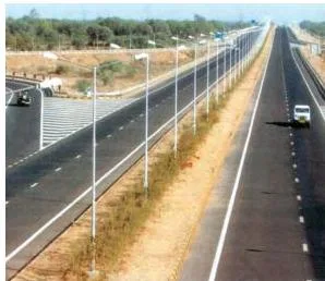
Roads are also classified by material: metalled roads (cement, concrete, or bitumen) are all-weather roads, while unmetalled roads go out of use in the rainy season.
The BRO also built the Atal Tunnel, the world’s longest highway tunnel at 9.02 km, connecting Manali to the Lahul-Spiti valley throughout the year at an altitude of 3000 metres in the Pir Panjal range (NCERT, p. 74).
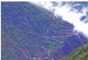
Railways: Gauges and Physiographic Factors
Railways are the principal mode of transportation for freight and passengers. The Indian Railways is the largest public sector undertaking, reorganised into 17 zones. The first train steamed off from Mumbai to Thane in 1853 (NCERT, p. 74).
The railway network runs on multiple gauge operations extending over 67,956 km:
| Gauge | Width (metres) | Route (km) |
|---|---|---|
| Broad Gauge | 1.676 | 63,950 |
| Metre Gauge | 1.000 | 2,402 |
| Narrow Gauge | 0.762 and 0.610 | 1,604 |
| Total | 67,956 |
The distribution pattern is influenced by physiographic, economic, and administrative factors. The northern plains are favourable due to level land and high population density. The Himalayan region is unfavourable due to high relief, sparse population, and lack of economic opportunities. The Konkan railway along the west coast facilitated movement but faced sinking tracks and landslides (NCERT, p. 75).
Pipelines: A New Arrival
Pipeline transport is a new arrival on India’s transportation map. Initially used for water, pipelines now transport crude oil, petroleum products, and natural gas. Solids can also be transported when converted into slurry (NCERT, p. 75).
The initial cost of laying pipelines is high, but subsequent running costs are minimal. Pipelines rule out trans-shipment losses or delays. There are three important networks:
- From upper Assam to Kanpur, via Guwahati, Barauni, and Prayagraj.
- From Salaya in Gujarat to Jalandhar in Punjab, via Viramgam, Mathura, Delhi, and Sonipat.
- The 1,700 km Hazira-Vijapur-Jagdishpur (HVJ) cross country gas pipeline.
India’s gas pipeline infrastructure has expanded from 1,700 km to 18,500 km of cross-country pipelines.
Waterways: The Cheapest Mode
Waterways are the cheapest means of transport, most suitable for carrying heavy and bulky goods. They are fuel-efficient and environment friendly. India has inland navigation waterways of 14,500 km in length (NCERT, p. 75). The National Waterways Act, 2016 declared 111 inland waterways as National Waterways. The first five are:
| NW No. | Waterway | Length (km) |
|---|---|---|
| NW-1 | Ganga river (Prayagraj to Haldia) | 1,620 |
| NW-2 | Brahmaputra river (Sadiya to Dhubri) | 891 |
| NW-3 | West-Coast Canal in Kerala | 205 |
| NW-4 | Godavari and Krishna rivers | 1,078 |
| NW-5 | Brahmani river and East Coast Canal | 588 |
Airways: The Fastest Mode
Air travel is the fastest, most comfortable, and prestigious mode of transport. It can cover difficult terrains like high mountains, dreary deserts, dense forests, and long oceanic stretches with great ease (NCERT, p. 78).
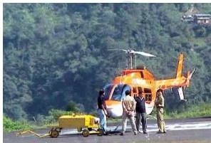
Air travel is preferred in the north-eastern states due to big rivers, dissected relief, dense forests, frequent floods, and international frontiers. Pawan Hans Helicopters Ltd. provides services to inaccessible areas and difficult terrains. The UDAN (Ude Desh ka Aam Nagrik) scheme promotes regional connectivity by making flying affordable for the common citizen (NCERT, p. 78).

Definitions Digest: Trade, Communication, and Tourism Terminology
Memorising terminology is easier with a structured table. Here are the key terms a student needs to know for the exam.
| Term | Meaning | Example / Key Fact |
|---|---|---|
| Golden Quadrilateral | Six-lane super highways linking Delhi-Kolkata-Chennai-Mumbai and Delhi | Implemented by NHAI; reduces time and distance between mega cities |
| Balance of Trade | Difference between a country’s exports and imports | Favourable: exports > imports; Unfavourable: imports > exports |
| Hinterland | The inland region served by a port (its area of influence) | Tuticorin and Kolkata have rich hinterlands |
| Tidal Port | A port where water levels are governed by tides | Deendayal Port (Kandla) and Kolkata require dredging due to tides |
| First-class Mail | Cards and envelopes airlifted between stations | Covers both land and air transport |
| Second-class Mail | Book packets, registered newspapers, and periodicals | Carried by surface mail (land and water) |
| International Trade | Trade between two countries via sea, air, or land routes | Considered the economic barometer of a country |
| Mass Communication | Communication providing entertainment and creating awareness | Includes radio, TV, newspapers, magazines, books, and films |
Communication and International Trade as Economic Barometers
Communication and trade together form the economic barometer of a country. Understanding how information flows through personal and mass channels, and how goods flow across borders, is central to this chapter.
The Communication System
Personal communication and mass communication are the major means of communication in India. The Indian postal network is the largest in the world. To facilitate quick delivery of mails in large towns and cities, six mail channels have been introduced: Rajdhani Channel, Metro Channel, Green Channel, Business Channel, Bulk Mail Channel, and Periodical Channel (NCERT, p. 78).

India has one of the largest telecom networks in Asia. Villages are covered with the Subscriber Trunk Dialling (STD) facility. The uniform rate of STD facilities all over India has been made possible by integrating the development in space technology with communication technology.
Doordarshan, the national television channel, is one of the largest terrestrial networks in the world (NCERT, p. 80). Digital India is an umbrella programme to prepare India for a knowledge-based transformation, focusing on IT (Indian Talent) + IT (Information Technology) = IT (India Tomorrow).
International Trade and Balance of Trade
Trade between two countries is called international trade. Advancement of international trade is an index to a country’s economic prosperity, making it the economic barometer for a country (NCERT, p. 80). No country can survive without international trade because resources are space bound.
Export and import are the components of trade. The balance of trade is the difference between export and import. A favourable balance of trade occurs when exports exceed imports. An unfavourable balance occurs when imports exceed exports.
India has trade relations with all the major trading blocks. The commodities exported include gems and jewellery, chemicals, and agriculture and allied products. India has emerged as a software giant, earning large foreign exchange through the export of information technology.
Tourism as a Trade
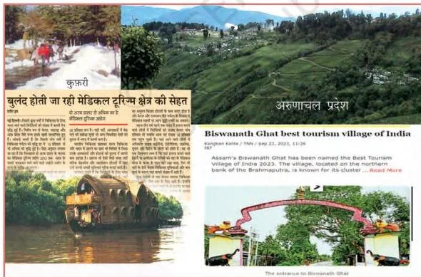
Tourism has grown remarkably over the past two decades. To boost tourism, schemes like Swadesh Darshan 2.0, Vibrant Village Programme, PRASHAD (Pilgrimage Rejuvenation and Spiritual Heritage Augmentation Drive), and Paryatan Mitra have been started (NCERT, p. 81). Tourism promotes national integration, provides support to local handicrafts, and develops international understanding about our culture and heritage.
Major Ports and Trade Routes Figure Walkthrough
India has a long coastline of 11,098.81 km, dotted with 12 major and 200 notified non-major ports. These major ports handle 95 per cent of India’s foreign trade (NCERT, p. 77). Mapping these ports from west to east is a standard exam requirement.
| Coast | Port | Key Feature |
|---|---|---|
| West | Deendayal (Kandla) | Tidal port; developed after Partition to ease Mumbai port |
| West | Mumbai | Biggest port with spacious natural and well-sheltered harbour |
| West | Jawaharlal Nehru (JNPT) | Planned to decongest Mumbai port and serve as a hub port |
| West | Mormugao (Goa) | Premier iron ore exporting port; ~50% of India’s iron ore export |
| West | New Mangalore (Karnataka) | Caters to export of iron ore concentrates from Kudremukh mines |
| West | Cochin | Extreme south-western port at entrance of a lagoon with natural harbour |
| East | V.O. Chidambaranar (Tuticorin) | Extreme south-eastern port with natural harbour and rich hinterland |
| East | Chennai | One of the oldest artificial ports; ranked next to Mumbai in trade volume |
| East | Visakhapatnam | Deepest landlocked and well-protected port; outlet for iron ore exports |
| East | Paradwip (Odisha) | Specialises in the export of iron ore |
| East | Kolkata | Inland riverine port; serves Ganga-Brahmaputra basin; requires constant dredging |
| East | Haldia | Subsidiary port to relieve growing pressure on Kolkata port |
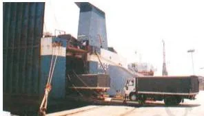
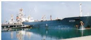
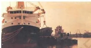
The west coast ports handle exports and imports for the productive belt of Jammu and Kashmir, Himachal Pradesh, Punjab, Haryana, Rajasthan, and Gujarat. The east coast ports serve the mineral-rich and agricultural belts of eastern India.
Worked Example: Calculating the Balance of Trade
This worked example uses original numbers to show how to calculate and interpret the balance of trade. The textbook explains the concept but does not provide a numerical example, so this helps students understand the application.
- Step 1: State the formula. Balance of Trade = Value of Exports \( – \) Value of Imports.
- Step 2: Substitute the original values. Assume a country’s exports for a financial year are valued at Rs 4,500 crores and its imports are valued at Rs 3,200 crores.
\[ \text{Balance of Trade} = 4500\ \text{crores} – 3200\ \text{crores} \]
\[ \text{Balance of Trade} = 1300\ \text{crores} \]
Step 3: Interpret the result.
Since the value of exports (Rs 4,500 crores) exceeds the value of imports (Rs 3,200 crores), the balance of trade is positive.
This is called a favourable balance of trade.
Final answer: The balance of trade is Rs 1,300 crores, which is a favourable balance of trade because exports exceed imports.
Now consider the reverse scenario. If exports were Rs 3,200 crores and imports were Rs 4,500 crores, the balance would be \( 3200 – 4500 = -1300 \) crores. This negative value indicates an unfavourable balance of trade, as imports exceed exports.
Common Mistakes Students Make in This Chapter
This table pairs common student errors with the correct rule and a way to check your answer. Examiners consistently target these specific misconceptions.
| Mistake | Correct Rule | How to Check |
|---|---|---|
| Calling Kandla (Deendayal) a natural harbour | Deendayal Port is a tidal port, not a natural harbour (NCERT, p. 77) | Recall it was developed after Partition to ease Mumbai; tidal ports require dredging |
| Thinking pipelines only carry liquids | Pipelines can carry solids converted into slurry (NCERT, p. 75) | Check if the question mentions refineries like Barauni or Mathura |
| Writing broad gauge width as 1.6 m | Broad gauge track width is 1.676 metres (NCERT, p. 75) | Memorise: Broad (1.676), Metre (1.000), Narrow (0.762 and 0.610) |
| Confusing NHAI with BRO | NHAI implements Golden Quadrilateral; BRO builds border roads | NHAI = National Highway Authority; BRO = Border Roads Organisation (est. 1960) |
| Saying Kolkata is a natural harbour | Kolkata is an inland riverine port and a tidal port requiring constant dredging of Hooghly (NCERT, p. 77) | Riverine ports are on rivers, not on the open sea coast |
Exam Notes: What to Highlight for Boards
Examiners look for specific points and keywords in your answers. The chapter exercises on page 82 of the textbook give a clear map of what is asked: MCQs test factual recall (corridors, gauges, ports), 30-word answers test specific definitions, and 120-word answers test synthesis.
- Physiographic factors and railways: A favourite long-answer question. State how level land favours tracks in northern plains, while high relief, sparse population, and lack of economic opportunities make the Himalayas unfavourable. Mention the Konkan railway as a specific example of overcoming challenges (sinking tracks, landslides). Naming at least three unfavourable regions (sandy plains of western Rajasthan, swamps of Gujarat, forested tracks of MP/Chhattisgarh/Odisha/Jharkhand) earns full marks (NCERT, p. 75).
- NHAI vs BRO: Distinguish their roles clearly. NHAI implements super highway projects; BRO constructs and maintains border roads. Both are government undertakings but serve different functions (NCERT, p. 72).
- Favourable vs Unfavourable Balance of Trade: Define both terms precisely. Always state that favourable means exports exceed imports and unfavourable means imports exceed exports (NCERT, p. 80).
- Air travel in north-eastern states: A recurring value-based question. State the specific geographical challenges: big rivers, dissected relief, dense forests, frequent floods, and international frontiers (NCERT, p. 78).
- Pipelines as a new arrival: Explain why pipelines are considered new on the transport map. Mention that solids can be transported as slurry and that they rule out trans-shipment losses (NCERT, p. 75).
For the full chapter text, you can access the official NCERT Class 10 Contemporary India II textbook chapter 7 on the NCERT website. You may also find our broader CBSE notes hub useful for cross-subject revision, and details on the previous chapter in our Manufacturing Industries notes.
Revision Recap: One-Glance Summary
Use this compact summary for last-minute night-before revision. Each mode is captured in one line with its key facts.
- Roadways: Second largest network in the world; 6 classes of roads; Golden Quadrilateral links Delhi-Kolkata-Chennai-Mumbai; NHAI implements super highways; Atal Tunnel (9.02 km) by BRO.
- Railways: Largest public sector undertaking; 17 zones; Broad Gauge (1.676 m) is the main track; first train Mumbai to Thane (1853); physiography affects distribution (northern plains favourable, Himalayas unfavourable).
- Pipelines: New arrival; 3 networks (Assam-Kanpur, Salaya-Jalandhar, HVJ); carry crude oil, gas, and solids as slurry; no trans-shipment loss; high initial cost, low running cost.
- Waterways: Cheapest means; fuel-efficient; 5 National Waterways (NW-1 Ganga, NW-2 Brahmaputra, NW-3 West-Coast Canal, NW-4 Godavari-Krishna, NW-5 Brahmani); 111 declared under National Waterways Act 2016.
- Airways: Fastest and most comfortable; preferred in north-eastern states (difficult terrain); UDAN scheme for regional connectivity; Pawan Hans for inaccessible areas.
- Communication: Indian postal network is largest in the world; 6 mail channels; STD facility integrated with space technology; Doordarshan is largest terrestrial network; Digital India programme.
- Trade: Exchange of goods; international trade is economic barometer; balance of trade = exports \( – \) imports; favourable (exports > imports) vs unfavourable (imports > exports).
- Tourism: PRASHAD, Swadesh Darshan 2.0, Vibrant Village Programme; promotes national integration and local handicrafts; India is largest producer of feature films.
Frequently Asked Questions About Lifelines of National Economy
Why are pipelines considered a new arrival on the transportation map of India?
Pipelines are considered a new arrival because historically they were used only to transport water to cities and industries. Their use for transporting crude oil, petroleum products, and natural gas from oil and gas fields to refineries, fertilizer factories, and thermal power plants is a recent development. Solids can also be transported through pipelines when converted into slurry.
The far inland locations of refineries like Barauni, Mathura, and Panipat became possible only because of pipelines (NCERT, p. 75).
How does the physiography of India affect the distribution pattern of the railway network?
The northern plains with their vast level land, high population density, and rich agricultural resources provided the most favourable conditions for railway growth. In contrast, the Himalayan mountainous regions are unfavourable due to high relief, sparse population, and lack of economic opportunities.
It was also difficult to lay railway lines on the sandy plain of western Rajasthan, swamps of Gujarat, and forested tracks of Madhya Pradesh, Chhattisgarh, Odisha, and Jharkhand. The Konkan railway along the west coast faced problems like sinking of track and landslides (NCERT, p. 75).
Why is international trade considered the economic barometer of a country?
International trade is considered the economic barometer because the advancement of a country’s international trade is an index to its economic prosperity. No country can survive without international trade because resources are space bound.
The balance of trade (the difference between exports and imports) indicates whether a country is in a favourable or unfavourable economic position in global commerce (NCERT, p. 80).
What is the difference between metalled and unmetalled roads as per the NCERT textbook?
Metalled roads are made of cement, concrete, or even bitumen of coal, making them all-weather roads usable throughout the year. Unmetalled roads go out of use in the rainy season because they are not made with these binding materials and become muddy or impassable (NCERT, p. 74).
Why is air travel preferred in the north-eastern states of India?
Air travel is preferred in the north-eastern states because the region is marked by big rivers, dissected relief, dense forests, and frequent floods, along with international frontiers. These geographical features make the construction of roadways and railways difficult and expensive.
Air travel can cover these difficult terrains with great ease, making access easier in the absence of other transport options (NCERT, p. 78).
Reference: NCERT Class 10 Contemporary India II textbook, chapter 7 Lifelines of National Economy.
Explore Class 10 Geography Notes
Class 10 Geography on LearnCBSE:
Related chapters: